Cities & Towns
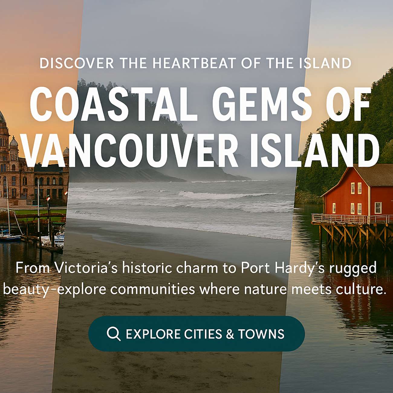
Cities and towns listed from Victoria in the South to Port Hardy in the North with a description of each town and the milage between each of the municipalities. Every town has something different to offer from ocean seaside settings, farmland, mountain regions or rugged wilderness.
| Vancouver Island Alert Bay BC |
|
Alert Bay is on Cormorant Island, formerly a thriving fishing village on the BC coast. Heritage buildings and old village houses on the waterfront still speak of the early pioneer days, where a fish saltery was in 1870. The waterfront boardwalks, ferry dock and marinas bustle with life, but most vivid today is the living culture of the ‘Namgis First Nation of the Kwakwaka’wakw. |
| Vancouver Island Bamfield BC |
|
Bamfield, a tiny resort hamlet nestled
quietly in a protected inlet on the south shore of Barkley
Sound, is best known for its superb salmon fishing adventures. Time and Distance from Victoria: 3 h 42 min (166.1mi= 267.3120km) via HWY-1 N, HWY-19 N |
| Vancouver Island Black Creek BC |
|
The Black Creek area is convenient to Mount
Washington Alpine Resort Ski Resort on Mount Washington, located
19 miles (31 km) west of Hwy 19 at Courtenay. Time and Distance from Victoria: 3 h 40 min (164mi= 263.9324km) via HWY-1 N, HWY-19 N |
|
Vancouver Island Campbell River BC Distance: 257 km or 160 mi Approximate Time: 2 hrs, 57 min Route: 1, 19 |
|
Discovery Islands to the east, and
adjacent to Quadra Island this city is located on the frontier
of a BC wilderness, and has a population of more than 30,000
Time and Distance from Victoria: Hwy 1, 19 heading Northwest K264 M164 3 hrs, 0 mins |
| Vancouver Island Chemainus BC |
|
Artists from around the globe were invited to
paint huge heritage murals on the sides of buildings,
transforming a small coastal mill town into the world's
largest outdoor art gallery. |
| Vancouver Island Cobble Hill BC |
|
A tiny farming village in the Cowichan
Valley, Cobble Hill is surrounded by a picturesque landscape and
enveloped by a warm climate.
|
| Vancouver Island Colwood BC |
|
Colwood is bordered by the town of View Royal
and the district of Langford to the north and west, and by the
district of Metchosin to the south. |
| Vancouver Island Comox BC |
|
Surrounded by a beautiful valley, and the
largest glacier on Vancouver Island, the charming seaside
village of Comox is located on a peninsular. |
| Vancouver Island Cowichan Bay BC |
|
Today, the village of Cowichan Bay and the
surrounding area is home to a host of artists, craftspeople, and
cottage industries - including some fine local wineries. |
| Vancouver Island Crofton BC |
|
Cradled by verdant hillsides and surrounding
mountains, the active community of Crofton is situated on the
calm waters of Osborne Bay in the Cowichan Valley.
|
| Vancouver Island Cumberland BC |
|
Located in the Comox Valley south of
Courtenay, and once Canada's smallest and westernmost city,
Cumberland was a bustling coal mining community |
|
Vancouver Island Courtenay BC Distance: 217 km or 135 mi Approximate Time: 2 hrs, 38 min Route: 1, 19, |
|
Located in the heart of some of the most
beautiful farming landscape on Vancouver Island, Courtenay is
the urban centre of the Comox Valley.
|
|
Vancouver Island Duncan BC Distance: 58 km or 36 mi Approximate Time: 0 hrs, 34 min Route: 1 |
|
The city is about 45 kilometres from both Victoria to the south and Nanaimo to the north.
Although the City of Duncan has a population of just over 5,000, it serves the Cowichan Valley which has a population of approximately 90,000,[2] many of whom live in North Cowichan and Cowichan Tribes. This gives Duncan a much larger perceived "greater" population than that contained within the city limits. People in areas of North Cowichan and bordering on Duncan usually use "Duncan" as their mailing address.
Duncan has one seat on the Cowichan Valley Regional District Board. The name Cowichan is an Anglicization of Halkomelem Quw̓utsun̓, which means "the warm land". |
| Vancouver Island Errington BC |
| Errington is located in the foothills of
Arrowsmith Mountain on Errington Road, off Highway 4, just south
of Parksville and Qualicum Beach on the east coast of central
Vancouver Island. |
|
Vancouver Island Esquimalt BC |
| The municipality of Esquimalt, incorporated
in 1912, has many heritage buildings and beaches with excellent
views of Victoria Harbour and the Strait of Juan de Fuca. |
| Vancouver Island Fanny Bay BC |
| Modern visitors are likely to be found with
white plastic pails, surveying the silt shores in search of the
oysters for which Fanny Bay is so well known. |
|
Vancouver Island Gold River BC |
| Gold River was always dependant upon the Pulp
Mill and the forest industry. Since the closure of the Pulp Mill
in October 1998, Gold River has focused on rebuilding the
community |
|
Vancouver Island Highlands BC |
| The Highlands is a stunningly beautiful rural
residential area just northwest of Victoria British Columbia
Canada. It's blessed with an exceptional abundance of scenic
beauty, native plant and animal life, and public parkland. |
| Vancouver Island Knights Inlet |
| The Knight Inlet area is a true west coast
adventure, with great towering mountains rising straight out of
the sea, cascading waterfalls and waterslides, and a history
rich in native culture. |
|
Vancouver Island Ladysmith BC |
| Nestled on the eastern shores of spectacular
Vancouver Island, the Town of Ladysmith features all of the
warmth and charm of small town living with a full range of
services and amenities. Ladysmith is a growing community
(population 7,538 in 2006) located just 88 km north of Victoria
and 23 km south of Nanaimo |
|
Vancouver Island Lake Cowichan BC |
| The town of Lake Cowichan is the gateway to
some of the most spectacular camping and hiking available on
Vancouver Island. Other communities such as Honeymoon Bay, |
|
Vancouver Island Lazo BC |
| Just outside of Comox, Lazo is close to
the Comox airport and harbour, also the city of Courtenay and
the city of Cumberland |
|
Vancouver Island Langford BC |
| Situated between Colwood and the Malahat, and
incorporating the head of Finlayson Arm and Mount Finlayson,
Langford offers an accessible diversity of beautiful parks and
lakes and limitless recreational activities. |
|
Vancouver Island Malahat BC |
| Traveling north from Victoria, Malahat Drive
climbs through imposing mature forests and over rugged
mountainside before dropping down into the Cowichan Valley. |
|
Vancouver Island Metchosin BC |
| The heart of Metchosin is at the Village
Centre, where Happy Valley Road and Metchosin Road intersect and
a few stores, a restaurant and a school are located. |
|
Vancouver Island Mill Bay BC |
| The surrounding parks and scenery are lovely
- perfect for hiking, cycling and boating. This is an ideal spot
to spend a few days, basking in the sun and swimming in warm
waters. |
|
Vancouver Island Nanaimo BC
Distance from Victoria: 110 km or 68 mi Approximate Time: 1 hrs, 29 min Route: 1 |
| Nanaimo is the only all-purpose port
city on Vancouver Island, with every facility required
to serve both the commercial and recreational needs of
business and tourism. |
|
Vancouver Island Nanoose Bay BC |
| The rural community of Nanoose Bay is
a hot spot for golfers, clam diggers and water sports
enthusiasts. |
| Vancouver Island North Saanich BC |
| Said to be the finest
rural-residential area in all of Canada, North Saanich
boasts a long coastline on three sides, enveloping
agricultural farmlands, cosy bays and generous protected
parklands. |
|
Vancouver Island Parksville BC Distance: 147 km or 91 mi Approximate Time: 1 hrs, 56 min Route: 1, 19, |
| Parksville boasts one of the finest
climates in Canada and is favoured as one of the most
popular summer family vacations destinations of
Vancouver Island and British Columbia |
|
Vancouver Island Port Alberni BC Distance: 193 km or 120 mi Approximate Time: 2 hrs, 32 min Route: 1, 19, 4A, 4 |
| Visitors come to Port Alberni
year-round to sport fish Alberni Inlet and Barkley Sound
for chinook, coho, and sockeye salmon. Salmon school in
the inlet before ascending to the spawning grounds. |
|
Vancouver Island Port Alice BC |
| The small community of Port Alice is
located on beautiful Neroutsos Inlet, one of Vancouver
Island's gateways to the wild and wonderful west
coast. |
|
Vancouver Island Port Hardy BC Distance: 497 km or 309 mi Approximate Time: 5 hrs, 36 min Route: 1, 19 |
| This turn-of-the-century Port Hardytown is now
the largest community in the region and the bustling
terminal for B.C. Ferries the service to Prince Rupert
and the Queen Charlotte Islands |
|
Vancouver Island Port McNeill BC Distance: 456 km or 283 mi Approximate Time: 5 hrs, 5 min Route: 1, 19 |
| Port Mcneill situated in a sheltered
harbour is also a launching point for sports fishing
enthusiasts who test their skills in the maze of
waterways between Vancouver Island and the mainland. |
|
Vancouver Island Renfrew BC |
| A small village at the end of Highway
14 on the southwest coast of Vancouver Island, Port
Renfrew calls itself The Jewel of the West Coast, |
| Vancouver Island Qualicum Beach BC |
| Steeped in quaint British heritage
and famous for its local arts, crafts and beautiful
English gardens, modern day Qualicum Beach offers
visitors the same gentle countryside and golden,
seemingly endless, sandy beaches. |
|
Vancouver Island Royston BC |
| Royston is located south of Comox, in
the Comox Valley. Transportation links to the Comox
Valley include rail, bus, car, ferry, and air service,
including floatplane access. |
|
Vancouver Island Saanich BC |
| The largest municipality in Greater
Victoria, Saanich offers the charm of country life
mingled with the convenience of urban residential
neighbourhoods and close proximity to the provincial
capital of Victoria. |
|
Vancouver Island Saanichton BC |
| Located on the Saanich Peninsula of
Greater Victoria, Saanichton is well known for flowers
and rose gardens. |
|
Vancouver Island Salt Spring Island BC |
| Salt Spring Island is the
largest, most populated, and most visited of the
Southern Gulf Islands. |
|
Vancouver Island Saratoga Beach BC |
| At the north end of the Comox
Valley, at the mouth of the Oyster River,
Saratoga Beach may be the ultimate stretch of
shimmering sand on the sheltered east coast of
Vancouver Island. |
|
Vancouver Island Sayward BC |
| The friendly residents of the
small coastal settlement of Sayward on Kelsey
Bay live in a spectacular natural environment in
the Sayward Valley of North Vancouver Island. |
|
Vancouver Island Shawnigan Lake
BC |
| Shawnigan Lake is located approximately 48 km (30 mi) north of Victoria, and borders the communities of Cobble Hill and Mill Bay. Several new residential developments have been built, both in the Shawnigan Lake area as well as in surrounding areas. The village of Shawnigan Lake, located on the eastern shore, contains two small general stores, three restaurants, several beaches and various small businesses including a barber, gas station,pharmacy and two coffee shops. There is a museum, run by the Shawnigan Lake Historical Society. The north-west end of the village also includes many summer cabins and a large lakeside park. The south end of the lake is largely undeveloped, discounting the lake shore itself, with scattered farmland and numerous hiking trails. The Kinsol Trestle, also known as the Koksilah River Trestle, is a wooden railway trestle located on Vancouver Island north of Shawnigan Lake in the Canadian Province of British Columbia. It provides a spectacular crossing of the Koksilah River |
|
Vancouver Island Sidney BC |
| Sidney-by-the-Sea appeals to
those who enjoy both seafaring excursions and
land-based adventures. There are many inlets and
nearby islands, 3 km of public accessible
waterfront - including many beaches and great
beachcombing |
|
Vancouver Island Sooke BC |
| Sooke enjoys some of the
mildest climate in western Canada, with warm and
dry summer months, and wet and mild winter
months. Sooke's unspoiled beaches,
meandering rainforest trails and breathtaking
vistas of Washington State's Olympic
Mountains |
|
Vancouver Island Tahsis BC |
| Tahsis is a west coast
village, offering a wide range of accommodation,
a full-service marina and a safe, friendly small
town atmosphere that boasts a fascinating blend
of history lessons and outdoor adventures. |
|
Vancouver Island Telegraph Cove BC |
| Telegraph Cove is a tiny town
and a major destination during the summer
months, when the snug little bay bustles with
boaters, anglers, campers, kayakers and
whale-watchers . |
|
Vancouver Island Tofino BC Distance: 315 km or 196 mi Approximate Time: 4 hrs, 5 min Route: 1, 19, 4A, 4 |
| Tofino is a pretty fishing
village at the tip of Esowista Peninsula near
the entrance to Clayoquot Sound on the west
coast of Vancouver Island. Tofino is a rapidly
growing tourist centre |
|
Vancouver Island Ucluelet BC |
| Ucluelet is situated in the
Long Beach unit of Pacific Rim National Park,
located between the villages of Tofino and
Ucluelet - the most accessible and most
developed component of the Pacific Rim National
Park. |
|
Vancouver Island Victoria BC |
| The Victoria region covers
the extreme southern end of Vancouver Island,
including the Saanich Peninsula, Victoria,
Esquimalt, Colwood, Metchosin, and Sooke, with
almost half of Vancouver Island's population
of over 750,000. |
|
Vancouver Island Zeballos BC |
| Nestled among towering
forest-cloaked mountains, Zeballos sits at the
head of Zeballos Inlet, gateway to Nootka Sound,
world-famous for salmon fishing and kayaking
opportunities |